I have very few fields where I have straight headlands. We do almost all of our headlands in a contour pattern. It takes some major time to layout, create, name and record the guidance lines. Being able to save them and recall them is paramount in our situation. I realize this in not the case for everyone, but I would think that most people that need RTK accuracy will need the ability to save the lines. This is a typical example of one our fields. The line labeled "Main" is the line used in the field body. The rest of the lines are head lands. The yellow is the field boundary and the brown lines are the guidance lines. I would start planting this field on the main line and plant the headlands as I come to them. Being able to switch back and forth between lines is a must. 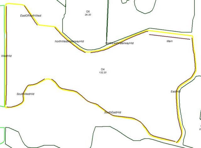
Our biggest problem is that we have trees around many of our fields. These tress will block too many satellites and we will loose signal. We make two passes on the headlands. Many times we will make the second pass first with the marker down for the 1st pass. Then we return on the first pass and can follow the marker if we loose signal. This is only possible if the contoured lines are saved. I want to try a glonass capable receiver to see if having more available satellites will help with the signal blockage problems. We save our lines and use them year after year. We are using controlled traffic. The same lines are used for multiple operations (planting, spraying, side dressing, etc). |  Leica mojoRTK - Reality Check

