| As already answered, for seeding - field potential zones (multi-layer approach: multi-year vegetation, LIDAR topography (not just elevation)). We've automated and patented the process of creation of such maps.
If you have good-quality Yield data - you could also integrate yield data sets into Field potential maps, check #2 Multi-layer zones with yield data and other data sources (topography, soil, sensor, satellite) .
An example of seeding rates calculations from South Dakota University.
Fertilization - based on soil sampling (grids or zones). Also, it is often very effective to make zonal soil sampling based on Multi-layer Field Potential maps. Nutrients per crop demand recommendations you can calculate, an example. In GeoPard we embedded many popular Nutrient recommendations. It's achieved using Equation-based analytics (you can also create your own equations, not just use default provided by us).


Edited by GeoPardAg 8/5/2022 05:22
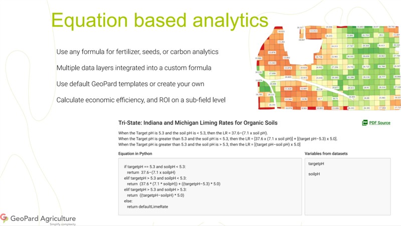 (GeoPard - Equation-based analytics (full).png) (GeoPard - Equation-based analytics (full).png)
Attachments
----------------
 GeoPard - Equation-based analytics (full).png (69KB - 333 downloads) GeoPard - Equation-based analytics (full).png (69KB - 333 downloads)
|
 Prescription maps

