|
SE Iowa | Here's some of the images that I have created from the past year
Picture 1: We found streaks diagonal across this field. Figured out that last year during harvest the organic matter coming out of the back of the combine wasn't broadcast very well. We made sure it did this year!
Picture 2: An NDVI map of a field of corn in late may
Picture 3: A prescription map made from the NDVI map for sidedressing nitrogen
Picture 4: We found 40 year old clay tile in a soybean field. Now we have the lines geo-referenced in SMS
Picture 5: We knew of a aphid issue in a wheat field, so we flew right after we found out. Determined with NDVI map and ground truthing that 34 of the 160 acre field was infested from aphids.
Remember, we are only finding reflective STRESS from issues, not the issues themselves.
Edited by dronedude 12/15/2015 20:20
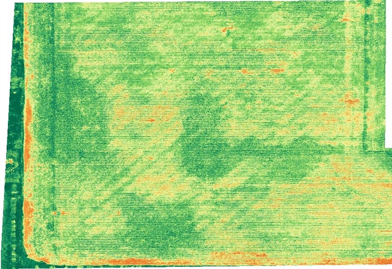 (combine issues.jpg) (combine issues.jpg)
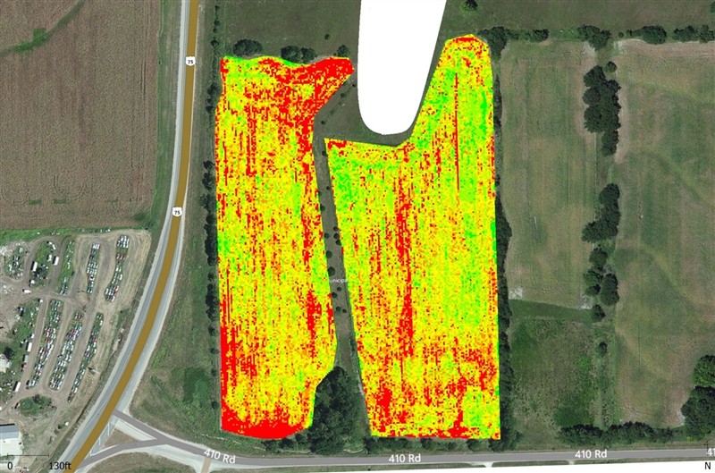 (sms ndvi.jpg) (sms ndvi.jpg)
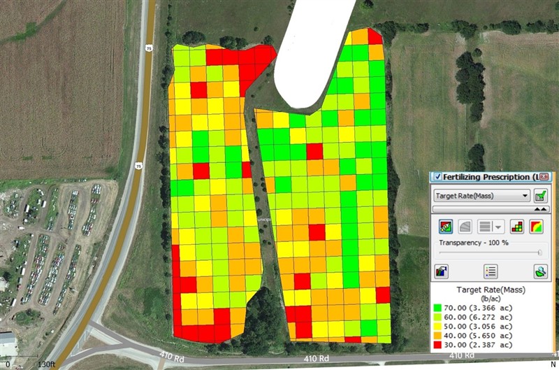 (sms rx.jpg) (sms rx.jpg)
 (tile beans.jpg) (tile beans.jpg)
 (wheat aphids.jpg) (wheat aphids.jpg)
Attachments
----------------
 combine issues.jpg (210KB - 538 downloads) combine issues.jpg (210KB - 538 downloads)
sms ndvi.jpg (171KB - 527 downloads)
sms rx.jpg (139KB - 521 downloads)
tile beans.jpg (136KB - 519 downloads)
wheat aphids.jpg (139KB - 528 downloads)
| |
|
 What do you use your drone for?

