You can import any spatial layer via GeoPard as a map layer (geospatial picture).
And just recently we started to support sending Yield maps as operational harvesting files (as-applied and other will be added soon).
Check some samples here : https://geopard.tech/johndeere (topography, soil, NUE, etc.)
To compare layers you can do send a layer from GP to JD (but it's only a visual comparison, not a statistical).
All options you have with GP + JD integration:
- on JD Side: Import Yield and Spray maps from JD into GeoPard, send Spray maps from GP as a map layer to JD -> use JD compare layers functionality
- on GP side: Compare layers view (up to 4 layers live, synced maps), see link and pics below
- on GP side: Run intersections algorithms, to calculate areas affected, a sample is below - on GP side: Run GeoPard Correlation algorithm - we calculate spatial correlation between layers and create a new layer out of it; a sample is below
The trial is totally free at app.geopard.tech (you can also sign up with your John Deere account).
Compare any spatial layer in John Deere Ops center (a spatial layer need to be sent from GeoPard):
Compare layers in GeoPard:

Compare layers youtube 15 sec video
Layers intersections sample:
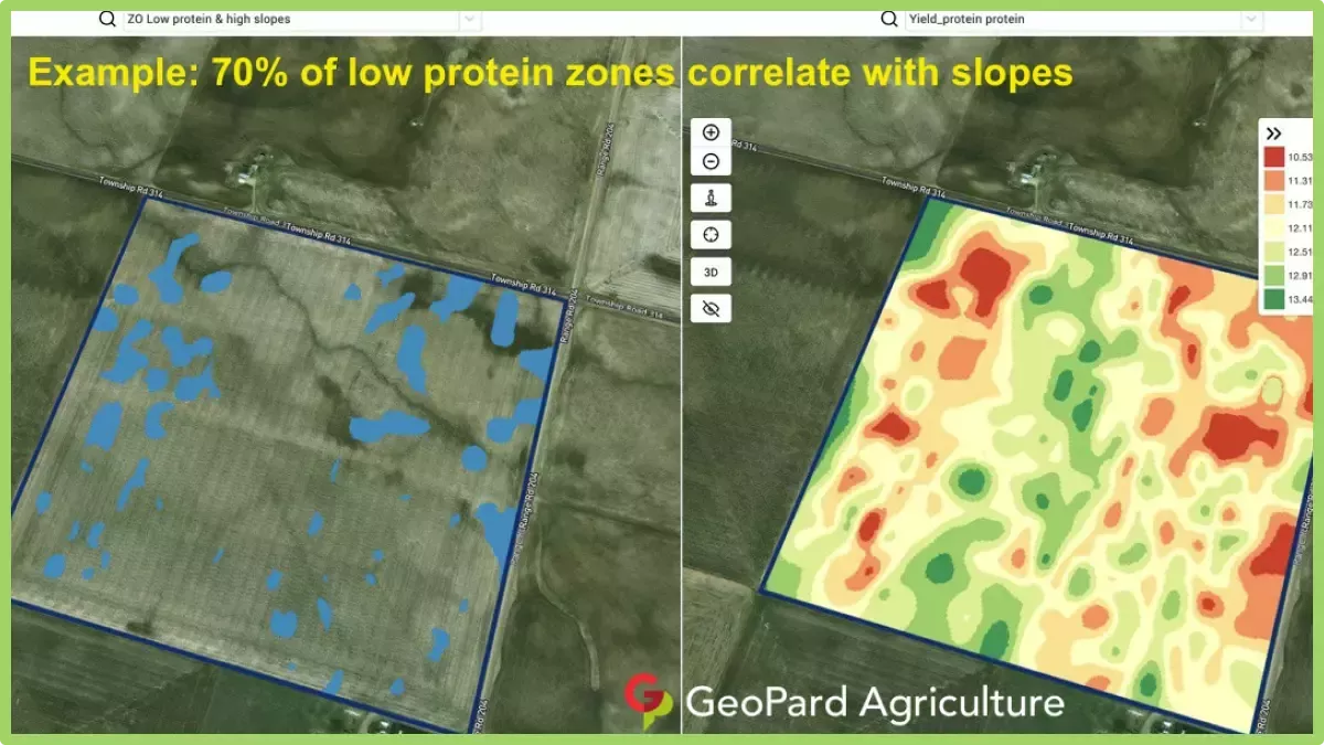
Spatial correlation between layers
Edited by GeoPardAg 11/28/2024 06:04
 (NUE Map in the JohnDeere Ops Center (full).png) (NUE Map in the JohnDeere Ops Center (full).png)
Attachments
----------------
 NUE Map in the JohnDeere Ops Center (full).png (84KB - 4 downloads) NUE Map in the JohnDeere Ops Center (full).png (84KB - 4 downloads)
|  Shape files into Operation Center?

